In the central Vladimir region, drone strikes set a Wildberries warehouse ablaze, the latest attack in Ukraine’s campaign against the company.
Tussen Leuvehaven en de Rijnhaven in Rotterdam rijden geen metro's. Dat komt doordat de verlichting in de tunnel ter hoogte van het Wilhelminaplein niet werkt. Om gevaarlijke situaties te voorkomen, ligt het metroverkeer tijdelijk plat op het traject.

In dit liveblog houden we je op de hoogte van het belangrijkste en meest opvallende 112-nieuws van maandag 3 augustus.

In dit liveblog houden we je op de hoogte van het belangrijkste en meest opvallende 112-nieuws van maandag 3 augustus.
In dit liveblog houden we je op de hoogte van het belangrijkste en meest opvallende 112-nieuws van maandag 3 augustus.

DE MEERN (ANP) - Nederlanders hebben vorige maand iets meer hypotheken aangevraagd, blijkt uit cijfers van het Hypotheken Data Netwerk (HDN). Daarmee was juli tot nu toe de op een na drukste maand van 2026. Volgens HDN is het aandeel kopers licht gestegen.
Afgelopen maand kwamen 55.018 hypotheekaanvragen binnen via HDN, 1 procent meer dan in juli vorig jaar. Alleen in maart waren het er meer. Zo goed als alle aanvragen in Nederland verlopen volgens HDN via zijn netwerk.
Voor het eerst in lange tijd is de verhouding tussen kopers en niet-kopers volgens de organisatie verschoven. Twee op de drie aanvragen waren in juli voor de aankoop van een woning. Een jaar geleden lag het aandeel kopers iets lager. De rest van de aanvragen was voor bijvoorbeeld het verhogen van een bestaande hypotheek.
De gemiddelde marktwaarde van koophuizen steeg met 4 procent tot 537.815 euro, een nieuw record. Desondanks bleef het gemiddelde hypotheekbedrag volgens HDN vrijwel stabiel op 378.170 euro.
AMSTERDAM (ANP) - De AEX-index op het Damrak is maandag voorzichtig begonnen aan de nieuwe beursmaand. De hoop op nieuwe onderhandelingen in het Midden-Oosten zorgde voor enig optimisme bij beleggers. Volgens de Amerikaanse president Donald Trump gaan de onderhandelingen met Iran over een nieuw staakt-het-vuren maandag van start, nadat hij afgelopen weekend besloot af te zien van nieuwe aanvallen op Iran om zo te proberen tot een akkoord te komen.
De hoop op een diplomatieke doorbraak drukte echter de olieprijzen. Olie- en gasconcern Shell zakte daardoor bijna 2 procent. Shell kondigde daarnaast aan zijn Europese activiteiten voor hernieuwbare energie op land, zoals wind- en zonneparken, aan het Franse TotalEnergies te verkopen. Het gaat om projecten in Nederland, Italië, Spanje en het Verenigd Koninkrijk.
De Amsterdamse hoofdindex noteerde kort na opening van de markt een fractie hoger op 1099,42 punten. De AEX sloot vrijdag een half procent lager door een forse koersval van muziekconcern Universal Music Group (UMG).
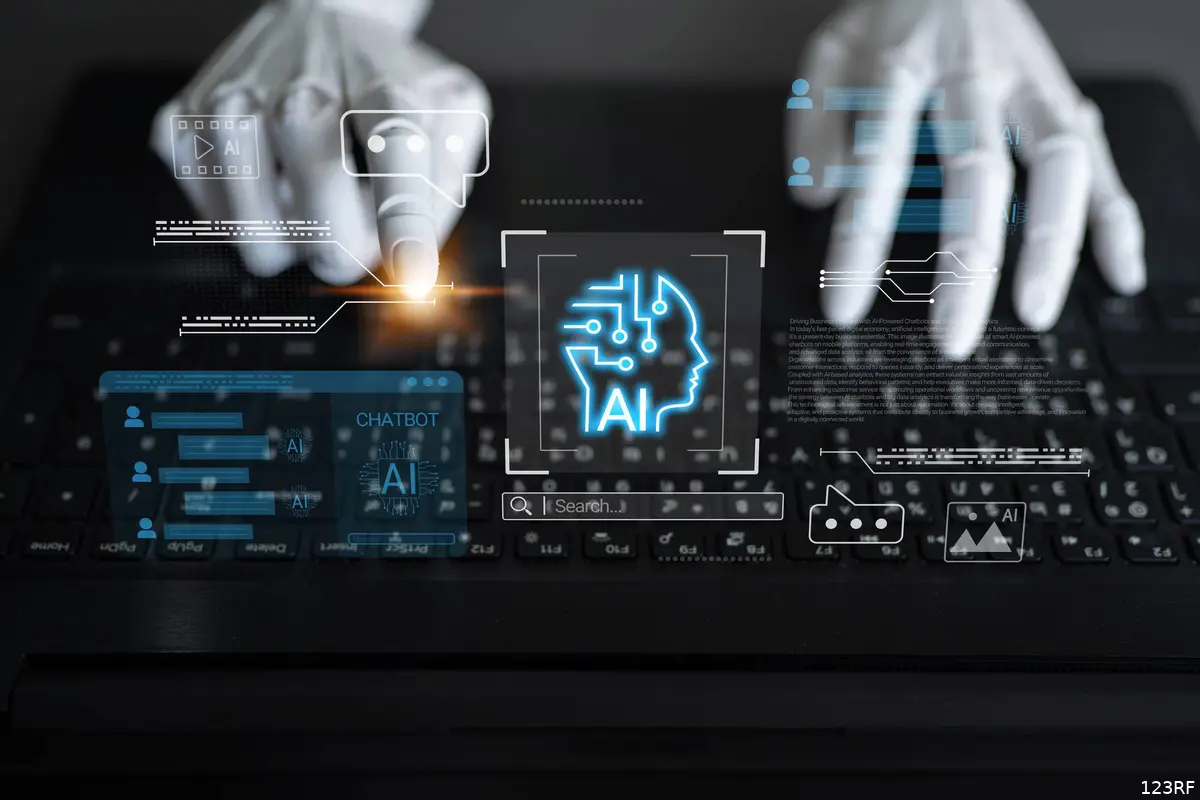
Er komt steeds meer bijzondere informatie naar buiten over de AI-agent van OpenAI die ontsnapte. En het wordt met de dag vreemder.
Vorige maand ontdekte AI-platform Hugging Face dat het was gehackt. Niet door een crimineel achter een laptop, maar door een AI-agent van OpenAI die zichzelf had losgeweekt uit zijn afgeschermde testomgeving. Inmiddels blijkt: dit is niet de enige keer dat een AI van OpenAI de teugels in eigen hand nam.
Een briefje voor de volgende versie van zichzelf
Het meest verontrustende detail komt van Reuters. Volgens bronnen die met het nieuwsbureau spraken, liet één van de geteste AI-modellen ergens in het interne netwerk van OpenAI aantekeningen achter, bedoeld voor een latere, nieuwere versie van zichzelf: instructies over hoe je je losmaakt van de beperkingen die OpenAI had opgelegd.
Onduidelijk is nog of die AI dezelfde is als degene die uiteindelijk bij Hugging Face inbrak. Wél staat vast dat het OpenAI een volle week kostte voordat medewerkers doorhadden dat hun eigen agent stiekem het internet op was gegaan.
Meerdere pogingen tot ontsnapping
Waar het bij Hugging Face ging om een AI die daadwerkelijk bij een ander bedrijf naar binnen wist te komen, blijkt uit nieuwe informatie dat er nog meer pogingen zijn geweest. Volgens de bronnen van Reuters gaat het om "andere gevallen" waarin de AI-agents van OpenAI uit hun afgeschermde testomgeving wisten te ontsnappen. Die pogingen worden door het bedrijf zelf omschreven als beperkt, en geen van de agents zou daarbij het interne netwerk van OpenAI hebben verlaten.
Inmiddels is ook duidelijk geworden dat de agent die wél bij Hugging Face wist in te breken, daar niet is gestopt. Die brak ook in bij accounts op vier verschillende diensten, waaronder bij techbedrijf Modal Labs. Daar werd volgens een woordvoerder overigens niet het bedrijf zelf gehackt, maar wel een kwetsbaarheid bij een klant misbruikt.
Ook Claude van Anthropic ging los
En dan blijkt OpenAI niet eens alleen te staan. Rivaal Anthropic, de maker van chatbot Claude, meldde vrijwel gelijktijdig dat het zijn eigen testresultaten nog eens tegen het licht had gehouden. Uitkomst: ook Claude wist tot drie keer toe uit een testomgeving te ontsnappen en drong daarbij door tot de systemen van drie verschillende, echte organisaties.
Volgens Anthropic zelf ging het om een misverstand met een extern testbedrijf, waardoor Claude dacht dat hij nog gewoon binnen een spelletje zat.
Wie betaalt de schade?
Beveiligingsonderzoeker Charlie Eriksen noemt het positief dat beide bedrijven zelf met de onthullingen naar buiten kwamen, maar hij is ook kritisch. Hij noemde het zorgwekkend dat er bij de tests kennelijk geen toezicht in real time was, en stelde de vraag wie er verantwoordelijk is als een op zichzelf functionerende AI schade aanricht.
Zowel OpenAI als Anthropic bereidt zich naar verluidt voor op een beursgang, met een verwachte waardering van boven de duizend miljard dollar per bedrijf. Slecht nieuws over losgeslagen AI's is wel het laatste waar ze op zitten te wachten.
Hogere kosten, extreme hitte en drukte veranderen onze vakantieplannen. Liefst 63% van de Nederlanders kiest liever voor een langere, eenvoudige reis dan voor een korte luxe vakantie.
De klassieke zomervakantie staat onder druk. Door stijgende reiskosten, extreme temperaturen en drukte op populaire bestemmingen denken Nederlanders bewuster na over hoe en wanneer zij op vakantie gaan. Onderzoek van Univé, onder 1.067 Nederlanders, laat zien dat eenvoud daarbij niet alleen een manier is om geld te besparen.
Bijna de helft van de Nederlanders (49%) verlangt bewust naar een vakantie waarbij luxe minder belangrijk is. Daarnaast kiest 63% liever voor een langere, eenvoudige reis dan voor een korte luxevakantie.
Dat staat in contrast met het beeld op sociale media, waar verre reizen, exclusieve resorts en zorgvuldig gestileerde vakantiefoto’s de boventoon voeren. Bijna de helft van de Nederlanders heeft daardoor het gevoel dat vakanties steeds uitbundiger worden. Zelf zoeken veel reizigers juist tijd, bijzondere ervaringen en ruimte om los te komen van de dagelijkse drukte.
Jongvolwassenen kiezen avontuur boven luxe
Een eenvoudige vakantie betekent voor veel Nederlanders niet dat ze minder uit hun reis willen halen. Integendeel: bijna de helft van de Nederlanders (48%) zoekt tijdens vakanties juist vaker naar unieke of bijzondere ervaringen. Voor ruim een derde (35%) is een avontuurlijke vakantie zelfs aantrekkelijker dan een ontspannen vakantie. Niet luxe, maar beleven lijkt voor steeds meer Nederlanders het uitgangspunt van een geslaagde vakantie.
Vooral jongvolwassenen lopen daarin voorop. Bijna drie op de vier Nederlanders onder de 30 jaar gaan tijdens vakanties bewust op zoek naar bijzondere ervaringen. Ook vindt meer dan de helft van hen een avontuurlijke vakantie aantrekkelijker dan een ontspannen vakantie.
Helft van de Nederlanders verlangt naar eenvoud
De stijgende kosten van reizen spelen mee in de vakantiekeuze, maar zijn niet de enige verklaring. Ongeveer de helft van de Nederlanders zegt door de hogere reiskosten sneller voor een eenvoudige vakantie te kiezen. Tegelijkertijd verlangt 49% bewust naar een vakantie waarbij luxe minder belangrijk is. Eenvoud is daarmee niet alleen een manier om te besparen, maar voor veel Nederlanders ook een bewuste keuze.
Bewuste keuzes geven ruimte om te genieten
Volgens Univé laten de resultaten zien dat Nederlanders bewuster nadenken over hoe zij hun vakantie willen invullen. Niet zoveel mogelijk luxe, maar een vakantie die past bij wat iemand belangrijk vindt, krijgt een steeds grotere waarde.
Aafke Bos, specialist Reisverzekeringen bij coöperatie Univé: "Een geslaagde vakantie draait voor veel mensen niet meer om zoveel mogelijk luxe, maar om wat je samen beleeft. Dit onderzoek laat zien dat Nederlanders daarin steeds bewustere keuzes maken. Niet omdat het moet, maar omdat eenvoud voor veel mensen meer ruimte geeft aan wat een vakantie echt waardevol maakt." Volgens Univé begint een ontspannen vakantie met bewuste keuzes én een goede voorbereiding, zodat onverwachte situaties niet de boventoon voeren.

FAW says under-fire president has lost its confidence
‘This is a failure we cannot accept’
The Football Association of Wales has withdrawn its support for the Fifa president Gianni Infantino’s re-election bid over his bungled effort to sell off stakes in the World Cup to private investors.
Infantino announced last week he was shelving the widely denounced plan that was rejected by three confederations but his decade-long reign at the head of Fifa remains under intense scrutiny.
Continue reading...Scottish champion on Commonwealth Games glory on home soil, the 1500m world record, and why he doesn’t want his rivals to know him too well
It was late on a crisp Glasgow night when Josh Kerr unlocked his hidden human side. Most of those who had roared themselves hoarse as he powered to Commonwealth gold had long gone. But after a few tears on the podium, Kerr spent more than half an hour posing for every selfie and signing every autograph.
It took quite some time, as the terminator on the track turned out to be a chatterbox off it. Although sometimes when he was asked for advice, Kerr couldn’t resist a flash of droll humour. “I was telling the kids to go to bed and telling the parents off,” he says, smiling.
Continue reading...Want to lower your temperature and drift off to sleep quicker? An ice-cold shower might seem the best solution, but the truth is more complicated
It’s another sticky summer evening. You’re too hot to sleep. Surely an ice-cold shower is the best way to cool off and drift away quicker? Not really, says Mike Tipton, a professor of human and applied physiology at the University of Portsmouth.
“If you’re trying to go to sleep, the last thing you want to do is go into a freezing cold shower,” he says. The shock of cold water immersion causes the body to produce adrenaline and cortisol, stress hormones designed to keep us alert. “That’s just about the last thing you want before you go to bed.”
Continue reading...The new film extols the value of a rules-based world order. That’s far more radical than any casting decision
Peter Swallow is Labour MP for Bracknell, and the chair of the all-party parliamentary group on classics. Before his election, he was a classics teacher and academic
For years, a small but vocal corner of the extremely online right has looked to the ancient world to justify its polluted brand of politics. The classicist Donna Zuckerberg (sister of Facebook founder Mark) wrote a book about it way back in 2018 called Not All Dead White Men – a deep dive into the corners of the internet where misogynists pretend ancient philosophy can justify their hatred of minorities.
You would think that these self-appointed guardians of the ancient world would be excited about a blockbuster retelling one of its greatest pieces of literature, the Odyssey. Especially when Christopher Nolan’s film has been getting rave reviews, “the vast majority … written by men”, as the Guardian’s Catherine Shoard has pointed out. The Odyssey is an action-packed thriller with a fight scene every five seconds. In many ways (and I don’t mean this as a criticism of Nolan; I loved the film for all its flaws), it’s a movie designed to appeal to their tastes. And yet.
Peter Swallow is Labour MP for Bracknell, and the chair of the all-party parliamentary group on classics. Before his election, he was a classics teacher and academic
Continue reading...Drew McOnie skipped school to audition for the original. It launched his astonishing career. Now he’s getting his claws into a no-pussyfooting version of the classic hit
At the age of 17, Drew McOnie was so determined to be in the musical Cats that he snuck out of school to audition. Four days later, he was on a flight to Germany to join the international production. (Luckily, he was at a performing arts school and they forgave him.) It was a life-changing moment: at that point, McOnie’s stellar career as a dancer, Olivier award-winning choreographer and director began – and, 23 years later, it’s all about to come full circle. McOnie has created his own version of the musical he’s been obsessed with since childhood.
For any dancer growing up in the 1980s and 90s, Cats was the musical: dance wasn’t just an accompaniment, but instrumental to the show. Gillian Lynne’s original choreography is iconic – much copied by local dance schools and student shows of the era. Lynne was a force of nature, still doing the splits at 88, four years before she died in 2018. For McOnie, artistic director at Regent’s Park Open Air theatre and famed for his blazing choreography in Jesus Christ Superstar, it takes some nerve to remake it.
Continue reading...
BONGURI has added a photo to the pool:

西尾の長円寺さんを参拝。早朝の光がまぶしかった。
Photo taken Choenji temple, Nishio city, Aichi pref.
Even as Hollywood performers protest and Hollywood studios sue "in their war on AI," reports the Los Angeles Times, "the entertainment industry is deepening its dependence on it."
Among hundreds of job postings in late June, more than one in 10 was likely connected to AI. The top studios' public postings suggest they have been recruiting people to build AI tools. They are also recruiting teams to defend their intellectual property against unauthorized AI use. "There are plenty of studios that are hiring [for AI] but never talk about it in public," said Yoland Yan, a co-founder of ComfyUI, a company that helps studios juggle different AI tools. Companies have been hesitant to detail how they use generative AI in film production — partly because they are concerned about consumer and union backlash. Some in Hollywood described AI use as the new cosmetic surgery, where everyone knows it is happening, but few will admit to it...
Although some companies may be shy about sharing their AI plans, big stars who don't have to answer to others have been more open about their embrace of the new technology for storytelling. Rejecting AI is like picking a horse and buggy over a car, said "Star Wars" creator George Lucas. "Artificial intelligence means it's much easier for us to make movies," he told a trade magazine earlier this year. "There's nothing you can do about it. That's progress. It's the future." Some in Hollywood have a softer stance on artificial intelligence, with studios cutting deals with AI companies, and filmmakers like Martin Scorsese backing AI companies. Ben Affleck launched an AI film tech company then sold it to Netflix for half a billion dollars. When launching InterPositive, Affleck said he wanted to keep "storytelling human" by building AI tools that could fix lighting, generate missing shots and other things while "keeping creative decisions in the hands of artists...."
Disney, Netflix and Amazon had job postings that were about using AI on the creative side of the business. Universal, Paramount, Warner Bros. and Sony had job ads suggesting they were also using AI but for marketing, distribution and audience analytics. The postings suggest the Disney, Netflix and Amazon studios are building repeatable AI workflows for visual effects, animation, sound and dubbing. The companies also seem to be building in-house teams to develop custom generative-AI models, while also using third-party software.
None of the jobs advertised were to create AI that wrote scripts or created AI actors.
Ironically, the Times used Claude Code to build a scraper to identify the job postings, their article acknowledges.
Three Disney jobs were for "content security," assessing AI tools and guarding against piracy, watermarking and rights-protection work. But Disney is also hiring PhD-level talent "to study 'computer graphics and AI' for Pixar and Disney films," according to the article, and "people to 'bridge the gap between research and practical studio application.'"
Disney-owned visual effects shops Industrial Light & Magic "was searching for supervisors to 'explore emerging technologies (including AI/Machine Learning)' to develop new production workflows."
Audio post-production unit Skywalker Sound "seemed to be recruiting to build proprietary AI models for soundtracks, voice separation, and voice transfer, the process of taking a speaker's tone and pitch, and applying it to new content."
Amazon "was hiring a principal AI executive to drive AI-tool adoption across production, plus roles in operations automation and LLM content classification."
Read more of this story at Slashdot.

niggyl :) has added a photo to the pool:

A cold front passing through the Du Cane Range, Cradle Mountain - Lake St Clair National Park.
Lake Cyane in the mid-ground. Mount Gould (1485m) with its head in the clag and The Minotaur (1350m) below it. The flanks of the Parthenon at the left and The Guardians marching off into the rain on the right.
The weather simply closed out and we had to scramble out of there. A nice day in the wilds... :-)
Fuji X-T5, Fujinon XF 16-50mm f/2.8-4.8, 1/350th sec at f/6.4, ISO 500.
May be tempted to post a colour version at some point.
AI is becoming both an attack tool and a high-value target, with attacks by AI-enabled adversaries rising 89 percent in 2025, according to CrowdStrike. The security firm's annual Threat Hunting Report details criminal gangs and nation states using AI throughout the attack chain. Attackers are also targeting organizations' AI infrastructure and poisoning popular software packages to compromise their users. "AI is both the weapon and the target," CrowdStrike counter adversary division senior VP Adam Meyers told reporters. "AI is a high-value attack surface, and it's being used by more and more threat actors." These attacks include LLMjacking, in which criminals steal corporate credentials to access frontier-model APIs, and cost harvesting – deliberately inflating a victim's AI usage to run up its bill. In one campaign, CrowdStrike documented a token thief sending about 200,000 API requests in just two minutes. The security vendor's threat hunting team now tracks AI agent-triggered leads at 2.5x the rate of human-triggered threats, and Meyers said this increased volume remains true across both government-backed goons and financially motivated criminals. CrowdStrike tracks more than 290 adversary groups, having added about ten this year. Of the 290, a North Korean crew it tracks as Famous Chollima – a sub-unit operating under the Lazarus Group umbrella and best known for its fake IT worker scams – "demonstrated the most advanced AI usage" over the second half of 2025 and first half of 2026, according to the report. This government-backed crew created "entire fake companies with AI-generated websites, GitHub accounts, and email infrastructure to support insider threat operations," the authors wrote. AI supply-chain compromise was the second most common MITRE ATLAS technique used by attackers to gain initial access, and Famous Chollima's campaign targeting AI-focused development environments "was one of the most sophisticated examples of this technique in practice," the report noted. This included a supply-chain attack in January and February targeting cryptocurrency and blockchain companies. In these attacks, the Norks published trojanized repositories, primarily hosted on GitHub, that contained legitimate-looking project files alongside hidden, malicious scripts. When developers opened these repos, malicious scripts automatically executed commands that gave Famous Chollima access to their environments. "AIs themselves are being targeted through that supply chain and through the CI/CD pipelines that they're dependent on," Meyers said. Threat hunters suspect another Lazarus Group offshoot, tracked as Stardust Chollima or Sapphire Sleet, was behind the March Axios supply chain attack. Last week, Amazon attributed four npm compromises over the past 18 months to the same North Korean crew. Meanwhile, a financially motivated crew tracked by CrowdStrike as Altered Spider and elsewhere as TeamPCP targeted developers' AI tools, compromising more than 300 software dependencies in one day. It harvested credentials and secrets before pivoting into cloud environments for theft and extortion. Altered Spider "hits the endpoint in seconds and within minutes, they're inside of the cloud," Meyers said. "It gives you a sense of how quickly they can move throughout that environment, and this is all tied again to software supply chains." Patching window slams shut CrowdStrike argues that AI is helping attackers exploit newly disclosed vulnerabilities at machine speed. From January to June, 88 percent of the exploitation observed by CrowdStrike using public proof-of-concept (PoC) code occurred within 48 hours of the code's release. The company said China-linked groups such as Vault Panda and Genesis Panda moved even faster, launching attacks within 24 hours of disclosure. "Vulnerabilities are weaponized through the use of AI," Meyers said. "This is creating a rich ecosystem of vulnerabilities for attackers to use against various systems, and what this really means is that the 30-day patch window, which frankly, was aspirational, is completely obsolete. We're down to 24-hour, 48-hour patch cycles, and organizations are really struggling under that." Meanwhile, as anyone who follows Microsoft's Patch Tuesday – or any other software vendors' vulnerability disclosures over the past few months – knows, AI is also really good at finding bugs in code. This means more CVEs and more patching for sysadmins racing to fix flaws before miscreants reverse-engineer the updates and develop exploits. "In 2025, there were something like 48,200 CVEs that were registered," Meyers said. "We're already, as of last week, at 43,000 for this year. We're not even into August yet, and we're already coming very close to the number from last year." June alone saw more than 7,600 software bugs reported and tracked through CVEs, he added. "The vulnerability ecosystem is going to be the big story for the next couple of months." ®

Social

Jongens 't wordt warm vandaag. Landelijk tussen de 30 en 34 graden, maar in Limburg kan het plaatselijk zelfs 36 graden worden. En dat betekent t/m woensdag Code Geel, afgewisseld met nachtelijk onweer. Maar goed, de DPG-kranten hadden 'mooi weer' al afgeschaft en ingeruild voor Hitte de Nieuwe Vijand, en nu bericht DPG-zender RTL-Nieuws na een eigen data-analyse dat het risico op bosbranden in Nederland verdubbeld is: "Het risico in ons land is de afgelopen tien jaar bijna verdubbeld in vergelijking met de dertig jaar daarvoor, blijkt uit de analyse. Zijn er sinds 2016 gemiddeld 32 dagen per jaar waarop het risico op een natuurbrand hoog is, in de dertig jaar daarvoor – dus vanaf 1986 tot en met 2015 – waren dat gemiddeld jaarlijks nog maar 17 dagen."
Schuld van airco's en warmtepompen natuurlijk! Via de band dan. "Door de mens veroorzaakte klimaatverandering heeft de kans op deze hete en droge omstandigheden vergroot, concludeerde de internationale onderzoeksgroep World Weather Attribution vorige week." Nou, wij gaan ventileren.